It was a beautiful day in Ketchikan, so we couldn't waste it inside. The weather said it'd rain later in the afternoon, so we wanted to get an early jump on the day. I met up with Ali around 9am and we headed up to Carlanna Lake Trail.
The beginning part of the Carlanna Lake Trail is wide and gradual. It's probably only about a 5-minute walk from the parking lot to the lake, at which point you're graced with this incredible view.
The lake is always calm, the reflection on point, and that lone tree is just begging to be photographed (check out my instagram of that tree from an earlier hike up here).
Walking alongside the lake is equally as relaxing. The trail meanders through the woods and peeks out two or three times to docks with benches so you can relax on the lake.
Just beyond the lake, you cross a bridge over a stream...
...and then the trail begins its incline. Not difficult, but noticeable. The sun rays were beaming through the tree limbs at this hour and it was gorgeous!
About 30 minutes past the bridge, you hit the Avalanche Chute. Well, you actually hit it about 15 minutes in, but that's just the bottom of it. The trail winds along the side of it and then cuts through the middle, which is much more picturesque.
As you can see at the top of that picture, the mountain is barren. It's too steep for any vegetation to grow (just like the cliffs in Misty Fjords), so there's nothing to hold the snow up when it accumulates. So every winter, an avalanche falls in the same spot and clears out this path below it. So right here, we're standing in the middle of the Avalanche Chute.
The trail continues to climb through the dense forest, and our morning sun continued to dance with the trees.
Around 11am, or two hours into your hike, we popped out into the open muskeg. At this point the trail becomes all but impossible to follow. Trail markers are placed sporadically throughout, but you will get lost. We got lost on a sunny day with clear visibility. I can only imagine how daunting it would be in clouds or rain. Look for orange or yellow diamonds and then keep heading in that same general direction until you see another one. But also take some time to turn around and admire the view of Carlanna Lake behind you.
About 30 minutes up through the muskeg and you reach the saddle, at which point you can see into the inner part of Revillagigedo Island and see other mountains and lakes. Here's Perseverance Lake:
From the saddle, you also have a clear view of Juno Mountain.
Ali, just on her second hike now (Deer Mountain was her first real hike) wanted to continue up the mountain, so we headed to the peak.
If you've been hanging out around my YouTube channel lately you know that I've been posting pretty regularly over there. To see what's captured in the frame when I speak to camera, I usually take a quick selfie and then delete it and record the video. But I liked this selfie, so it didn't get deleted.
We had to cross through a few more muddy patches, but overall it wasn't very difficult to summit Juno Mountain at 2600 feet. Just past the summit, we ran into five mountain goats. I didn't get any pictures - just video. So you'll have to wait for me to edit that if you want to see them.
We continued on past Juno Mountain with the goal of summiting Ward Mountain, walking through short trees and some pretty leaves that are just starting to change for the Fall.
We found out that the trail doesn't actually go over the summit of Ward Mountain. It circumvents it and starts to descend quickly down toward the lake. So we about-faced and started our trek back.
We also saw some very dark and ominous clouds approaching. You can see their shadow in this picture:
We skirted Juno Mountain trying to track the mountain goats to get a closer picture, but by the time we saw them again they were forever far away. We got back to the saddle and it had only started sprinkling, although it was looking much sketchier. And then in a matter of about 5 minutes, the whole storm hit and visibility dropped to a few hundred feet.
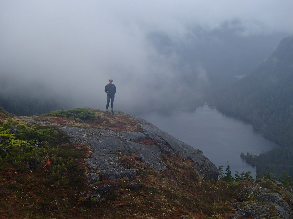
The hoodies and jackets came out and we started our descent since summiting Minerva Mountain would be less exciting with no view. The wind and rain picked up, but the clouds started to abate so at least we could see. The extra rain made our trail immensely more difficult though. We were slipping and sliding all over the place!
Once we got through the slippery and poorly marked muskeg, the rest of the trail was a breeze. We were back on the lower part of Carlanna Lake trail by 3:30.
And off the trail by 4pm. It was a fun seven hours. Thanks Ali for a great hike!
Showing posts with label alaska. Show all posts
Saturday, September 26, 2015
Thursday, September 17, 2015
Float Plane to Misty Fjords Alaska
Today we took our annual end-of-the-season excursion. In the past, we've taken helicopters to glaciers and chartered a boat to Tracy's Arm. This time we did something that's been on my bucket list for a long time. We took a float plane to Misty Fjords (to be honest, riding in a float plane was on my bucket list, Misty Fjords was not, but it should have been).
9/24 Update: If pics aren't good enough, the video is at the end of this post.
We flew with Taquan Air. Our group was split in two planes since there were 9 of us and one plane couldn't quite fit all of us. The flight took about 40 minutes from Ketchikan, around a few cool sights, and then landing in a calm inlet. Here's our route in case you're curious. (I was, which is why I put that thing together.)
I sat up front as the co-pilot for the first half.
This was my view.
9/24 Update: If pics aren't good enough, the video is at the end of this post.
We flew with Taquan Air. Our group was split in two planes since there were 9 of us and one plane couldn't quite fit all of us. The flight took about 40 minutes from Ketchikan, around a few cool sights, and then landing in a calm inlet. Here's our route in case you're curious. (I was, which is why I put that thing together.)
I sat up front as the co-pilot for the first half.
This was my view.
No comments:
Tags:
adventures,
alaska,
exploring,
flight,
float plane,
ketchikan,
misty fjords,
mountains
Sunday, September 13, 2015
Clock Tower Hike in Skagway Alaska
After a full day working at the store, the sun broke through the clouds for a second so I thought it was a perfect opportunity to go hiking. I'd never hiked in Skagway before, so I called the interns at our store and asked which one I should do. They decided to come along and show me in person.
They chose right. Less than 10 minutes into the hike and we were blessed with this view:
A little higher up the trail and we had to make a few decisions. Our options included Lower and Upper Dewey Lakes, Lower and Upper Reid Falls, a Reservoir, and Ice Lakes. "All of the above" was apparently not an option for tonight because we had to make it back by 6:30 for Burrito Night at Bonanza.
So we first hit the Reservoir.
Then we went off trail to an option that wasn't marked and some place neither of them had been yet. We wanted to find the cliffs with the painted clock tower on it. Except it was hard to see the clock tower from this vantage point.
They chose right. Less than 10 minutes into the hike and we were blessed with this view:
A little higher up the trail and we had to make a few decisions. Our options included Lower and Upper Dewey Lakes, Lower and Upper Reid Falls, a Reservoir, and Ice Lakes. "All of the above" was apparently not an option for tonight because we had to make it back by 6:30 for Burrito Night at Bonanza.
So we first hit the Reservoir.
Then we went off trail to an option that wasn't marked and some place neither of them had been yet. We wanted to find the cliffs with the painted clock tower on it. Except it was hard to see the clock tower from this vantage point.
No comments:
Tags:
alaska,
exploring,
hiking,
lakes,
mountains,
skagway,
views,
waterfalls
Saturday, August 29, 2015
Elfin Cove and Juneau Alaska Easy Hiking Trails
Isa came up to visit and we played (and worked) a lot! We did three hikes: Brotherhood Trail, the Flume Trail, and Mt Roberts (to the tram). Isa also took a side trip to Elfin Cove to visit her dad who was fishing there with some clients at the time. Here's a recap of her visit:
Kaxdigoowu Heen Dei (Brotherhood Trail)
It's super easy to get to if you have a car, which we don't, but not hard on the bus either. From downtown (Federal Building), the Route 4 Mendenhall bus took about 35 minutes. Just go out past Safeway and stop as soon as you cross the river. There's a little parking lot there and this view of the fireweed and Mendenhall Glacier is literally from the parking lot.
Kaxdigoowu Heen Dei (Brotherhood Trail)
I've wanted to see this view for a long time and never knew where it was until this season.
No comments:
Tags:
alaska,
brotherhood,
eagles,
elfin cove,
fireweed,
flume,
hiking,
juneau,
mt roberts trail,
trail,
video
Monday, August 24, 2015
Hiking Up in a Cloud, Down in the Dark
We started at 4:54. That's over an hour before I started last time, so I thought we were way good to make it back before sunset. But I learned that apparently I hike faster on my own than with a group (although hiking with a group is WAY more fun - and MUCH less dangerous/scary when hiking through bear country after dark).
We all worked a solid day at the store and then we converged on our apartment by the Deer Mountain trailhead. I made pasta and potatoes to give us some energy before hiking up (Yum!) and then we ventured up as a team. Harvey wanted to run the trail, so he took off immediately. The rest of us hiked at a normal human pace (Harvey is part super-human, part mountain goat). Eventually we caught him (because he came back down and then waited for us to get to the second viewpoint).
It was mostly cloudy for the entire hike, which was kinda fun while we were hiking through the clouds. It was like walking through the set of a horror movie.
We stopped at the usual spots: both viewpoints, the pond...
![]() |
| L to R, Morgan, Ali, Ryan, Kaitlyn, Kelsie, Reece, Tanner, Brian |
![]() |
| Brian and Harvey |
We stopped at the usual spots: both viewpoints, the pond...
No comments:
Tags:
adventures,
alaska,
bears,
fear,
hiking,
ketchikan,
mountains
Friday, August 7, 2015
Deer Mountain Hike - Lucky to Be Alive
Sometimes I'm smart. Tonight was not one of those times. Sorry Isa.
The internet said the hike is 4-5 hours roundtrip. Which usually means I can do it in 3. Either way, you probably should start earlier than 6:20pm unless you're hiking on the Solstice. Not today, when the sun set at 8:45 and it's pitch black by 10pm.
Also, you should bring a flashlight. And maybe a hiking buddy, seeing as this trail begins and ends in the dump, which is where all the cool bears go to hang out and wreak havoc. And maybe a ride home, so you don't have to walk 3 miles to your apartment after you finish your hike.
At least I brought snacks and water. And I was wearing sneakers! Woohoo!
Anyway, the trail is relatively easy on a day like today - no rain so not slippery. Most of it was pretty gradual inclines with a few flat stretches. It was a lot more leisurely than the mountains in Juneau. About 30 minutes up I hit the first viewpoint.
Another 30 minutes puts you up to the second viewpoint, which is the first time you get to see Ketchikan.
The internet said the hike is 4-5 hours roundtrip. Which usually means I can do it in 3. Either way, you probably should start earlier than 6:20pm unless you're hiking on the Solstice. Not today, when the sun set at 8:45 and it's pitch black by 10pm.
Also, you should bring a flashlight. And maybe a hiking buddy, seeing as this trail begins and ends in the dump, which is where all the cool bears go to hang out and wreak havoc. And maybe a ride home, so you don't have to walk 3 miles to your apartment after you finish your hike.
At least I brought snacks and water. And I was wearing sneakers! Woohoo!
Anyway, the trail is relatively easy on a day like today - no rain so not slippery. Most of it was pretty gradual inclines with a few flat stretches. It was a lot more leisurely than the mountains in Juneau. About 30 minutes up I hit the first viewpoint.
![]() |
| Looking south toward Metlakatla and Gravina Island |
Another 30 minutes puts you up to the second viewpoint, which is the first time you get to see Ketchikan.
No comments:
Tags:
adventures,
alaska,
bears,
fear,
hiking,
ketchikan,
mountains
Sunday, August 2, 2015
I Moved to Ketchikan
Today, Isa and I left Juneau and she went home to New York and I went to Ketchikan, Alaska. I know, not fair, right? It's no secret that I don't love Ketchikan. There may be some validity to it, but mostly it's just because I've spent so much time in Juneau. And Juneau and Ketchikan are rivals, just like New York and Boston are rivals. You claim one and automatically trash talk the other.
So me moving to Ketchikan is similar to me moving to Boston. Ew, right? But for no good reason.
Two things I legitimately dislike about Ketchikan are 1. The airport is on its own separate island so you HAVE to take a ferry across to the mainland to go into town. The ferry crosses the channel in all of about 5 minutes - it's narrow. They should just build a bridge and let the bus come straight out to the airport. 2. It rains a lot. Like, way too much. Average rainfall in the US is 39 inches per year. Average rainfall in Ketchikan is 141 inches!! Compare that to Juneau's 62 inches per year.
Anyways, it didn't rain today. And Ketchikan had its annual Blueberry Arts Festival and that was a LOT of fun. So my opinion of Ketchikan improved a little bit today. Here's a video of the festival.
So me moving to Ketchikan is similar to me moving to Boston. Ew, right? But for no good reason.
Two things I legitimately dislike about Ketchikan are 1. The airport is on its own separate island so you HAVE to take a ferry across to the mainland to go into town. The ferry crosses the channel in all of about 5 minutes - it's narrow. They should just build a bridge and let the bus come straight out to the airport. 2. It rains a lot. Like, way too much. Average rainfall in the US is 39 inches per year. Average rainfall in Ketchikan is 141 inches!! Compare that to Juneau's 62 inches per year.
Anyways, it didn't rain today. And Ketchikan had its annual Blueberry Arts Festival and that was a LOT of fun. So my opinion of Ketchikan improved a little bit today. Here's a video of the festival.
Sunday, July 12, 2015
Exploring the Treadwell Mine Ruins
I went for an exploration jog yesterday and two of my housemates decided to come with. We jogged across the bridge to Douglas and over to Sandy Beach, about 3 miles out. Just past Sandy Beach is the old ruin-town of Treadwell, full of ruins and broken down machinery.
It's one of those old abandoned places that I imagine grunge bands would use for some cd art or something.
![]() |
| Obviously, we are not a band. |
Tuesday, June 16, 2015
Mt Roberts, Gastineau, and Gold Ridge Trail Guide
Two down, three to go. (Of the five peaks in Juneau)
Tanner and I (and Panda, who had to bail early to go to work) hiked Mt. Roberts today. It was much longer and more difficult than we had anticipated. But much more worth it than I thought it'd be.
![]() |
| Douglas Island (left) and Downtown Juneau with Mt Roberts Tram station (center) and Father Brown's Cross (far right) |
We started hiking around 9:30am. Well, I left my apartment around 9am (at sea level) and hiked up to the interns' apartment on 7th (already at 200ft although it feels like way more than just 200ft). We took the 6th Street entrance because it takes so much longer to go around to Basin Road.
![]() |
| No longer maintained, but not technically off limits. |
There are a few landslides and downed trees that you have to traverse and the trail itself is a little overgrown, but for the most part it's an easy-to-follow trail. It takes about 45 minutes at a good pace to get up to the Mt Roberts Tram Station (1800ft). There you can refill water bottles, buy some snacks if you'd like, watch a movie about the history of the native people here, and say hello to Baltimore, a chill bald eagle rescue. This is also your halfway point to the top of Gastineau Peak, so it's a nice time for a break.
There's also a nature center with trail maps and a helpful guide who told us there's too much snow up top so don't attempt Gastineau or Mt Roberts. We didn't believe her, but it's nice to get a guides perspective anyways. I think she could sense our blasé attitude so she asked us to please check in on our return to make sure we came back safely and didn't fall off a cliff.
Above the tram we started to see some wildlife, with this Rock Ptarmigan.
![]() |
| Why can't you hear a Ptarmigan go to the bathroom? Because the P is silent. Bwahhahahaa. |
We also saw a bear cub scampering off. I didn't get a picture, but you can see him in the video at the bottom.
No comments:
Tags:
alaska,
bears,
eagles,
gastineau peak,
gold ridge,
hiking,
juneau,
mountains,
mt roberts,
mt roberts trail,
snow,
trail guide,
views
Wednesday, September 25, 2013
Helicopter up to Mendenhall Glacier
Today was epic.
As a reward for all the employees and interns that stuck it out until the end of the season, we treated everyone to a once in a lifetime experience: riding a helicopter to Mendenhall Glacier. We got a sweet deal through Temsco (THANK YOU!) to make this possible.
Here's a video of the entire experience, and then read below for more details and photos.
We had to split the team into two helicopters. Here's chopper 1:
Isa and I were in chopper 2 (along with three others), which meant we were able to follow them and get some sweet pics of the helicopter with the mountains to really show some scale.
The views were amazing and so drastically different from one minute to the next. From lush green valleys to jagged cliffs to the beautifully serene Juneau Icefield.
The Juneau Icefield was a highlight for me. I saw it briefly on a flight to Skagway back in July, but the weather wasn't nice like today. The sheer size and beauty of the icefield is astounding.
We had arranged to land on the icefield, but as you can see, there was a fresh blanket of snow across it so the pilots couldn't tell where a safe place to land would be. So we turned and headed over toward Mendenhall Glacier.
The pilots found a good spot to set us down and we disembarked and wandered the glacier with our crampons for grips (although they still weren't super trustworthy).
We tried not to fall into any crevasses, but at the same time we tried to get as close to them as possible to see how deep they went (DEEP!).
We took lots of pictures and drank the COLD water right from the streams (that's in the video).
After about 30 minutes of playing around on the glacier, we got back in our helicopters and flew straight down Mendenhall Glacier for some more sweet views.
And then back towards the airport for the end of a fantastic adventure.
As a reward for all the employees and interns that stuck it out until the end of the season, we treated everyone to a once in a lifetime experience: riding a helicopter to Mendenhall Glacier. We got a sweet deal through Temsco (THANK YOU!) to make this possible.
Here's a video of the entire experience, and then read below for more details and photos.
We had to split the team into two helicopters. Here's chopper 1:
Isa and I were in chopper 2 (along with three others), which meant we were able to follow them and get some sweet pics of the helicopter with the mountains to really show some scale.
The views were amazing and so drastically different from one minute to the next. From lush green valleys to jagged cliffs to the beautifully serene Juneau Icefield.
The Juneau Icefield was a highlight for me. I saw it briefly on a flight to Skagway back in July, but the weather wasn't nice like today. The sheer size and beauty of the icefield is astounding.
We had arranged to land on the icefield, but as you can see, there was a fresh blanket of snow across it so the pilots couldn't tell where a safe place to land would be. So we turned and headed over toward Mendenhall Glacier.
The pilots found a good spot to set us down and we disembarked and wandered the glacier with our crampons for grips (although they still weren't super trustworthy).
We tried not to fall into any crevasses, but at the same time we tried to get as close to them as possible to see how deep they went (DEEP!).
We took lots of pictures and drank the COLD water right from the streams (that's in the video).
After about 30 minutes of playing around on the glacier, we got back in our helicopters and flew straight down Mendenhall Glacier for some more sweet views.
![]() |
| Mendenhall Glacier with Mendenhall Lake and Auke Bay in the distance. |
And then back towards the airport for the end of a fantastic adventure.
1 comment:
Tags:
adventures,
alaska,
del sol,
glacier,
helicopter,
juneau,
mendenhall glacier
Subscribe to:
Posts (Atom)


